


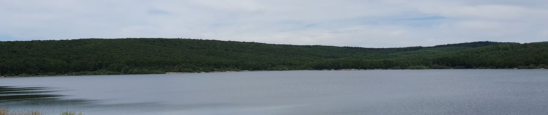
lac de laprade

gaetantouja
User
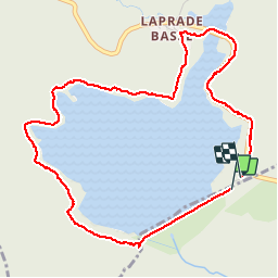

Length
5.4 km

Max alt
798 m

Uphill gradient
80 m
Km-Effort
6.4 km

Min alt
758 m

Downhill gradient
70 m
Boucle
Yes
Creation date :
2019-06-23 09:05:46.662
Updated on :
2019-06-23 12:06:28.885
1h53
Difficulty : Very easy

FREE GPS app for hiking
 SityTrail
IGN / Geographical institutes
SityTrail Plus
The world is yours!
About
Trail Walking of 5.4 km to be discovered at Occitania, Aude, Les Martys. This trail is proposed by gaetantouja.
Photos


Positioning
Country:
France
Region :
Occitania
Department/Province :
Aude
Municipality :
Les Martys
Location:
Unknown
Start:(Dec)
Start:(UTM)
441888 ; 4807282 (31T) N.
Comments